The sunken city Dolikhiste
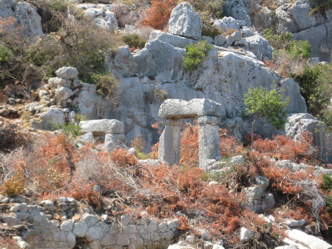
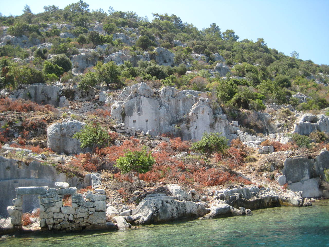
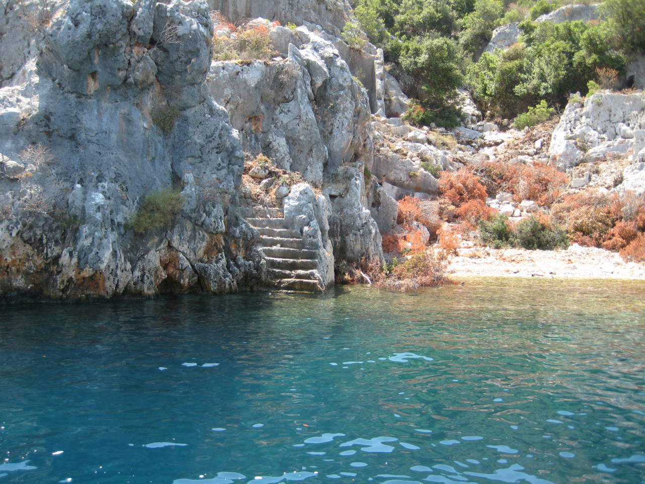
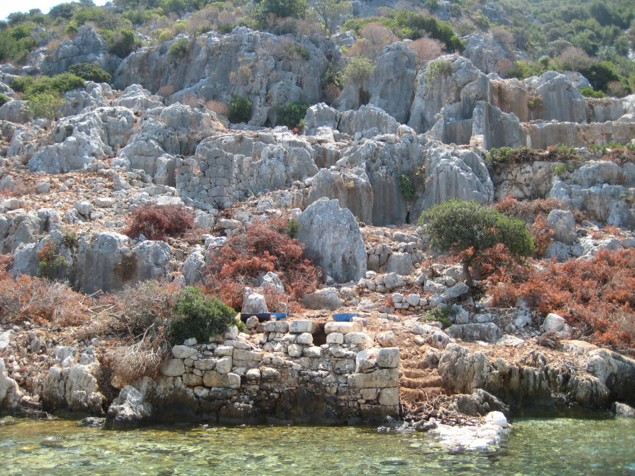
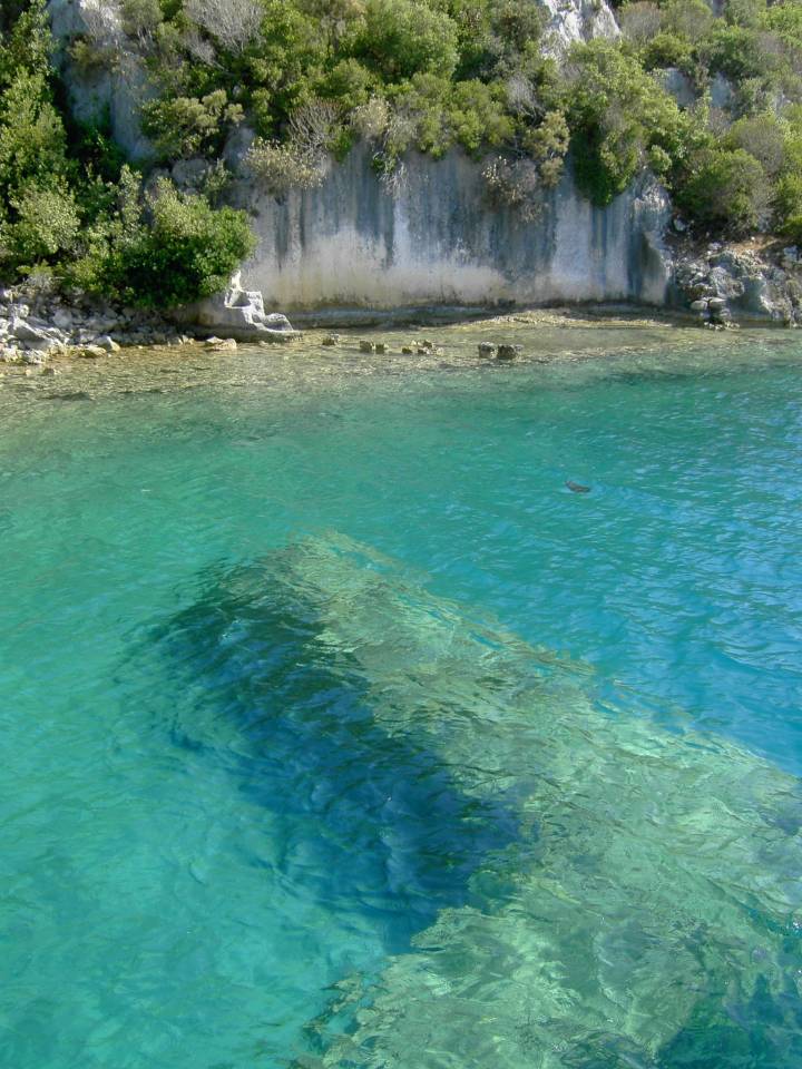
Dolikhiste was a city on the small Turkish island of Kekova. Today uninhabited island is 5.7 square kilometers in size and 7.5 km long and the highest elevation is 180 meters. In the past, our history many people have this protected bay estimated as the natural harbor and left their mark. Greeks, Romans and Venetians also built their fortifications here. Nowhere else will you find as many Lycian sarcophagi as here. In the quiet bay can be seen in dozens of small islands that they once inhabited. The ancient city Dolikhiste and their partially submerged ruins lie on the north side of the island. The small town was built in the 2nd century. Chr. Destroyed it during an earthquake but was rebuilt in the Byzantine era and again but then later abandoned. Which today are under water, the ruins of the old city is n on another earthquake in the 10th century. Chr. Due. From highly visible house remains on the banks carved into the rock stairs lead down into the crystal clear water. Also you can clearly see old foundations and the ancient millennium old port and its facilities under water in 2 meters deep. The ancient pillars of the ancient city project clearly from the crystal-clear water. About the island stands the ancient Simena, the fortress is shrouded by the setting sun in a soft light. From the small nearby port town Ücagiz boat trips to the sunken ruins. Since 1990, the island is a nature reserve and also snorkeling, diving or swimming is forbidden in the area of the sunken city. Thanks to the abgwlegenen situation prevents the nearby town of tourism can not be rolled over.